
|
|
| 2014 | |||
|---|---|---|---|
| Date | Peak | Elevation | Route |
| ... | ... | ... | ... |
| 12/6 | The Slab | 7,430' | Syzygy |
| 11/9 | Ridge 3 | ... | Angel's Way |
| Fifth Flatiron | ... | East Face South Side | |
| 8/10 | Pellea | ... | East Face |
| Onoclea | ... | Upper East Face from the Gash | |
| 8/9 | The Citadel | 13,294' | East Ridge |
| Pettingell Peak | 13,553' | Traverse from Citadel / South Slopes | |
| 8/6 | Third Flatiron | 7,220' | East Face Standard |
| 8/3 | Dinosaur Mountain | 7,380' | North Ridge |
| South Green Mountain | 8,073' | Up: East Face - Down: North Sneak | |
| Green Mountain | 8,144' | Greenman's Trail | |
| 8/2 | Overhang Rock | 6,820' | East Face into West Side (Story) |
| 8/1 | Third Flatiron | 7,220' | East Face Standard 1:15 |
| 7/31 | Smallest Goose Egg | ... | East Face |
| Northern Goose Egg | ... | East Face | |
| The Goose | 7,380' | East Face w/ Direct Start | |
| 7/28 | First Pinnacle | 6,220' | Inside West Face/McCrumm's Crack/SE Face/West Ridge |
| Third Pinnacle | WC | Trident to "Halls of Ivy" Variation | |
| Fourth Pinnacle | WC | Halls of Poison Ivy | |
| Fifth Pinnacle aka Gregory Flatironette | 6,420' | South Ridge | |
| 7/27 | Front Porch | 6,820' | South Ridge up, North Ridge down |
| 7/24 | Turret Ridge | 12,260' | West Gully |
| 7/18 | Fiddlehead | 7,580' | East Face |
| The Nebel Horn | 7,580' | Lark's Ascending | |
| 7/9 | Silver Plume Mountain | 12,477' | South Slopes |
| 7/6 | Nokhu Crags - North Summit | 12,485' | North Ridge to West Face |
| 7/4 | Dicker's Peck | 13,140' | Dicking Around |
| Navajo Peak | 13,409' | North Face | |
| 7/3 | "The Sail" | 6,340' | West Face |
| "Upper Echelon" | 6,380' | South Ridge | |
| "Crystal Wall" | 6,380' | South Ridge | |
| 6/26 | The Bastille | ? | West Buttress |
| 6/24 | First Flatironette | 6,780' | South Ridge |
| The Spy | 6,780' | East Face | |
| First Flatiron | 7,300' | North Arete | |
| 6/17 | Torreys Peak | 14,267' | Dead Dog Couloir |
| Grays Peak | 14,270' | From Torreys | |
| 6/16 | Second Flatiron | 7,140' | Freeway |
| First Flatiron | 7,300' | Baker's Way | |
| Macbeth | ? | West Ridge | |
| Witch's Cabin | ? | West Face | |
| 6/10 | First Flatiron | 7,300' | Baker's Way |
| 6/4 | First Flatiron | 7,300' | East Face Gully |
| 6/3 | Ridge 1 | 7,060' | Stairway to Heaven |
| Hillbilly Rock | 7,020' | North Face | |
| 6/1 | Hillybilly Flatironette East | ≈7,020' | South Ridge |
| Hillbilly Rock | 7,020' | East Face North Side | |
| The Hobo | ≈7,020' | East Face | |
| "Heaven" | 7,060' | Upper East Face aka Downclimb Route | |
| Anomaly | ≈7,060' | East Face | |
| Amoeboid | ≈7,200' | Buckets | |
| The Hourglass | ≈7,400' | East Face | |
| The Fist aka Hippo Head | 7,620' | South Ridge | |
| East Green Mountain | 7,980' | South Ridge | |
| Green Mountain | 8,144' | Upper Greenman's Trail | |
| Table Mountain | 6,220' | The Easy Way | |
| 5/31 | First Flatiron | 7,300' | East Face North Side to North Arete |
| 5/29 | Dinosaur Rock | 6,740' | Eastbone to South Ramp to West Face |
| 5/24 | First Flatiron | 7,300' | East Face Direct |
| 5/21 | First Flatironette | 6,780' | South Ridge |
| The Spy | 6,780' | East Face | |
| First Flatiron | 7,300' | North Arete | |
| 5/19 | Der Freischutz | 6,940' | South Ridge |
| 5/6 | Seal Rock | 7,260' | East Side North |
| 5/3 | Three Graces | 6,540' | Windows |
| Montezuma's Tower | 6,540' | North Ridge | |
| South Gateway Rock | 6,660' | South Ridge | |
| 4/25 | Second Flatiron | 7,140' | Freeway into Dodgeblock |
| First Flatiron | 7,300' | Baker's Way | |
| 4/12 | Icarus - North Summit | ? | West Side |
| Fatiron | ? | East Face | |
| 4/11 | Second Flatiron | 7,140' | Freeway into Dodgeblock |
| First Flatiron | 7,300' | Baker's Way | |
| 4/8 | Second Flatiron | 7,140' | Freeway |
| First Flatiron | 7,300' | Atalanta | |
| 4/1 | First Flatiron | 7,300' | Fandango |
| 3/31 | Second Flatiron | 7,140' | Freeway |
| First Flatiron | 7,300' | Baker's Way | |
| 3/16 | The Dome, Boulder Canyon | WC | Cozyhang |
| 3/15 | Second Flatiron | 7,140' | Freeway |
| First Flatiron | 7,300' | Baker's Way | |
| 2/23 | South Gateway Rock | 6,660' | South Ridge |
| The Three Graces | 6,530' | "Windows" | |
| Kindergarten Rock aka Grey Rock | 6,740' | South Ridge to North Summit Traverse | |
| North Gateway Rock | 6,740' | Tourist Gully | |
| 2/16 | Rocky Mountain | 9,250' | Southeast Slopes |
| Mount Manitou | 9,460' | Southeast Slopes | |
| PT 10,245' | 10,245' | South Slopes | |
| 1/26 | Third Flatiron | 7,220' | East Face Standard |
| 1/25 | "Front Porch" | 6,820' | East Face Center |
| "Lost Porch" | 6,860' | Southeast Ridge | |
| 1/24 | Horsetooth Mountain | 7,255' | South Ridge |
| "Middle Tooth" | 7,248' | East Face | |
| 1/18 | Third Flatiron | 7,220' | College Dropout |
| Tomato Rock | WC | South Face | |

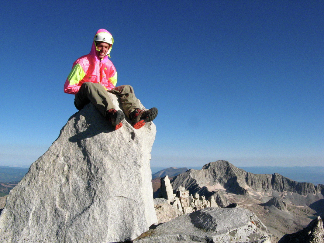
Maparju, Peru
|

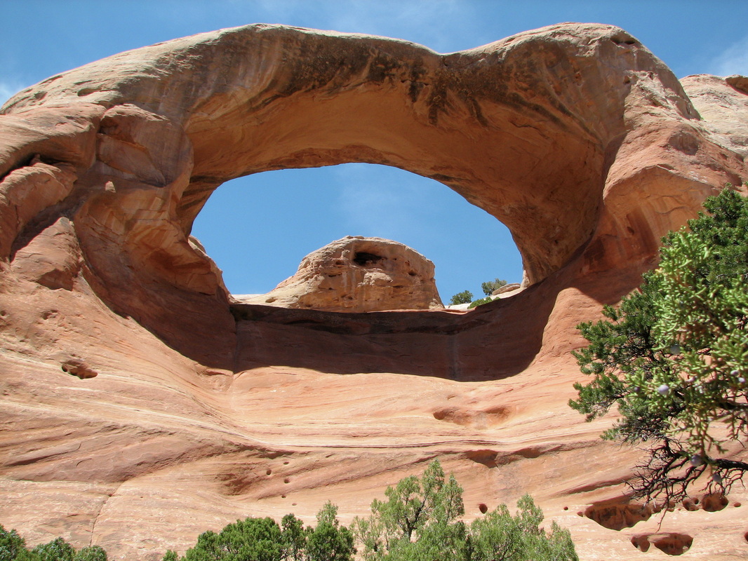
Mid-way up Fantasia - Fisher Towers, UT
|
| 2013 | |||
|---|---|---|---|
| Date | Peak | Elevation | Route |
| 12/30 | Mount Pisgah, OR | 1,530' | Standard |
| 11/16 | "Bishop Rock" | 8,260' | East Face |
| Banner Peak | 8,500' | North Face | |
| Cathedral Spires | 8,580' | East Face | |
| 11/10 | Harmon's Flatironette | ... | East Face North Side |
| The Seal | ... | East Face South Side | |
| The Pup | ... | North Ridge | |
| 11/9 | Dinosaur Mountain | ... | Mallory Cave Trail/Fum-Dum Col |
| Dum | ... | North Face | |
| Fum | ... | West Face | |
| Fo | ... | West Ridge | |
| Fi | ... | Fi Fun | |
| Fee | ... | North Ridge | |
| The Shark's Fin | ... | South Face | |
| The Hand | ... | East Face | |
| The Babyhorn | ... | East Face | |
| Square Rock | ... | Tree Climb | |
| 11/2 | Finger Flatiron | 7,140' | East Face |
| 10/21 | Third Flatiron | 7,220' | East Face Standard |
| 10/20 | Carson's Tower - Fisher Towers | ... | ... |
| 10/19 | Dock Rock - Fisher Towers | ... | ... |
| 9/21 | Cynical Pinnacle | ... | Center Route |
| 9/8 | "Rock Island I" - Boulder County | 5,660' | South Ridge |
| 9/7 | PT 8,100' - Larimer County | 8,100' | Scout Route |
| 9/2 | Haystack Rock - Larmier County | 7,438' | West Face |
| 8/10 | Devil's Thumb - Flatiron | 7,820' | East Face, Left Side |
| The Pyramid | 7,700' | North Face | |
| Devil's Horns | 7,900' | South and East Face(s) | |
| 8/4 | Devil's Thumb - Indian Peaks | 12,100' | Devil's Spiral |
| PT 12,660' | 12,660' | South Ridge | |
| 8/3 | Third Flatironette | 6,620' | Southeast Ridge |
| Third Flatiron | 7,220' | East Face Standard w/ Gash Variation | |
| Green Thumb | 7,300' | East Face | |
| Jaws | 7,300' | North Ridge | |
| "Terror Summit" | 7,420' | East Ridge | |
| 7/31 | Twin Sisters Peak East | 11,428' | Standard |
| Twin Sisters Peak West | 11,413' | Standard | |
| 7/24 | The Morning After | 7,250' | East Face |
| The Maiden | 7,386' | North Face | |
| 7/23 | Sunset Flatironette | 7,260' | Chase the Sun |
| First Flatiron | 7,300' | Southwest Face | |
| 7/20 | "Willy B" | 7,460' | Swing Time |
| 7/16 | "Schmoe's Nose" | 7,660' | East Face |
| 7/14 | The Seal | 7,260' | East Face South Side |
| 7/11 | "Petit Grepon" | 12,100' | South Face |
| 7/10 | Arthur's Rock | 6,780' | Standard |
| 7/7 | Hiamovi Mountain | 12,395' | Up: Southwest Slopes --> Down/Up: South Face/Ridge |
| "Hiamovi Tower" | 12,220' | West Ridge | |
| 7/6 | Cooper Peak | 12,296' | Up: North Ridge --> Down: Southwest Ridge |
| Marten Peak | 12,041' | Up: Northeast Ridge --> Down: Southwest Ridge | |
| "Martenette" | 11,361' | Northeast Slopes | |
| 7/5 | Mount Irving Hale | 11,754' | North Ridge |
| 7/2 | First Flatironette | ... | South Ridge |
| The Spy | ... | East Ridge | |
| First Flatiron | 7,300' | North Arete | |
| Sunset Flatironette | 7,260' | East Face | |
| Second Flatiron | 7,140' | West Ridge | |
| 7/1 | "Crosier Dome", Estes Park | 6,220' | West Ridge |
| PT 8,042', Estes Park | 8,042' | Northeast Slopes | |
| 6/28 | "T1", Eldorado Canyon | 6,820' | Icarus |
| 6/27 | "T1", Eldorado Canyon | 6,820' | Great Zot into the Dirty Deeds |
| 6/26 | "Wind Tower", Eldorado Canyon | 6,220' | Breezy |
| "The Bastille", Eldorado Canyon | 6,220' | West Side | |
| 6/23 | Nokhu Crags - North Summit | 12,485' | North Ridge to West Face |
| 6/18 | Dinosaur Mountain | 7,380' | Standard |
| "Red Devil" | 6,980' | West Face | |
| 6/1 | Maparaju, Peru | 17,769' | "Standard" |
| 5/13 | "Wind Tower", Eldorado Canyon | 6,220' | Boulder Direct to Recon |
| 5/6 | "Wind Tower", Eldorado Canyon | 6,220' | Wind Ridge |
| 5/5 | First Flatiron | 7,300' | Baker's Way |
| 4/28 | Devil's Tower, WY | 5,112' | Durrance |
| 4/3 | The Oracle - Fisher Towers, UT | 6,060' | Fantasia |
| 3/17 | Dunce Rock - Fisher Towers, UT | 4,780' | Standard |
| 3/10 | PT 7,180 (Jefferson County) | 7,180' | South Slopes from Windy Saddle |
| 3/8 | Castle Rock, Douglas County | 6,586' | Northeast Ledges |
| Tower of Babel, Garden of the Gods | ... | Triple Exposure | |
| 3/2 | Black Ridge (Mesa County) | 7,132' | Cross-country from Black Ridge Road |
| 2/15 | Mount Baldy (OR) | 1,224' | From Redtail Lane |
| 2/9 | PT 6,712' | 6,712' | North Slopes |
| "North Greyrock" | 7,681' | West Slopes | |
| "Aiguille du Greyrock" | 7,456' | South Face | |
| Greyrock Mountain | 7,613' | The Weenie Route | |
| 2/7 | PT 5,773 aka "Aggie Peak" | 5,773' | Standard |
| 2/3 | PT 5,773 aka "Aggie Peak" | 5,773' | Standard |
| 2/2 | Culebra Peak | 14,047' | Cielo Vista Ranch |
| 1/27 | West Pawnee Butte | 5,315' | Northeast Face |
| 1/26 | Third Flatiron | 7,220' | East Face Standard |
| Second Flatiron | 7,140' | Freeway to West Ridge | |
| First Flatiron | 7,300' | Bakers Way | |
| 1/20 | Shannon Benchmark, Morgan County | 4,935' | ... |
| Judson Hills, Morgan County | 4,921' | ... | |
| Fry Hill, Morgan County | 4,815' | ... | |
| Minter Hill, Morgan County | 4,785' | ... | |
| Stony Point, Morgan County | 4,775' | ... | |
| 1/19 | Longs Peak | 14,255' | North Face |
| 1/5 | Green Mountain | 8,144' | Greenman Trail |
| East Green Mountain | 7,980' | SE Slopes | |
| Royal Arch | 6,980' | East Face | |
| Flagstaff Mountain | 6,980' | South Slopes | |
| "Alamo Rock" | 6,380' | East Face | |
| "Crown Rock" | 6,380' | West Face | |
| 1/4 | Steamboat Rock, North - Larimer County | 6,945' | West Face |
| Steamboat Rock, South - Larimer County | 6,842' | West Face | |
| PT 7,940' - Larimer County | 7,940' | NW Slopes | |
| 1/3 | "The Box" | 7,180' | East Face |
| "Red Devil" | 6,980' | West Face | |
| "Gazebo East" | 6,580' | East Face | |
| "Portico" | 6,620' | South Slopes | |
| "Crown Rock" | 6,380' | West Face | |
Wind, Sand and Snow on Castle Rock North. Rabbit Valley, CO
|

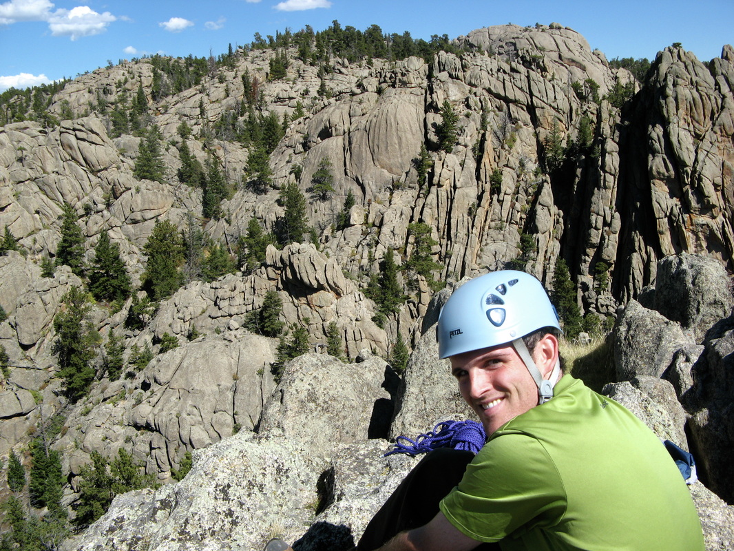
Russell relaxing on the Three Graces. Garden of the Gods, CO
|
| 2012 | |||
|---|---|---|---|
| Date | Peak | Elevation | Route |
| 12/31 | Cherry Hill | 5,046' | Parking Lot |
| 12/9 | Cherry Hill | 5,046' | Parking Lot |
| Mariana Butte | 5,269' | South Slopes | |
| 12/2 | "Terror Summit" | 7,420' | East Ridge |
| Third Flatiron | 7,220' | College Dropout | |
| Third Flatironette | 6,620' | Southeast Ridge | |
| 12/1 | Mariana Butte | 5,269' | South Slopes |
| 11/24 | PT 5,770 | 5,770' | NE Slopes |
| 11/19 | PT 4,980 - Grand County, UT | 4,980' | Standard |
| 11/17 | Looking Glass Rock, UT | 6,260' | Regular Route |
| PT 5,695 - San Juan County, UT | 5,695' | East Slopes | |
| Dock Rock, UT | ≈ 4,800' | Impish | |
| 11/10 | North Noddle Head | 8,224' | "Beau Knows" |
| South Noddle Head | 8,260' | Peak Bagger's Route | |
| 11/5 | Big Rock Candy Mountain | 8,285' | "Tom's Variation" |
| 10/28 | "The Bishop" | 8,100' | Ellingwood Chimney |
| Bishop Rock | 8,260' | Standard | |
| 10/27 | PT 7,012 | 7,012' | South Slopes |
| Mariana Butte | 5,269' | South Slopes | |
| 10/21 | Dark Angel - Arches N.P., UT | 5,580' | West Face |
| 10/20 | Three Gossips - Arches N.P., UT | 4,700' | West Face |
| 10/19 | Crooked Arrow Spire, UT | 6,100' | Longbow Chimney |
| 10/14 | PT 5,773 aka "Aggie Peak" | 5,773' | Standard |
| Mariana Butte | 5,269' | South Slopes | |
| 10/7 | South Gateway Rock | 6,660' | South Ridge |
| North Gateway Rock | 6,740' | Tourist Gully | |
| 10/4 | PT 5,773 aka "Aggie Peak" | 5,773' | Standard |
| 9/23 | Echo Tower, UT | 5,980' | Phantom Sprint |
| 9/21 | Rimrock Spire aka "the Bear", Debeque Canyon | ... | Bing Bong |
| The Bugeyed Monster, Palisade | ... | "Standard" | |
| 9/19 | Third Flatiron | 7,220' | East Face Standard |
| 9/11 | "Duncan's Ridge" | 5,740' | East Slopes |
| 9/9 | McReynolds Peak | 12,450' | West Face from 13,100' on Pikes Peak Road |
| Pikes Peak | 14,110' | Drove to top! | |
| "Little Pikes" | 13,363' | East Slope from Road | |
| "Devil's Playground Peak" | 13,070' | East Slope from Road | |
| 9/5 | Third Flatiron | 7,220' | East Face Standard |
| 8/19 | First Flatiron | 7,300' | Direct East Face |
| Third Flatiron | 7,220' | East Face Standard | |
| 8/18 | Torreys Peak | 14,267' | Kelso Ridge |
| Grays Peak | 14,270' | From Torreys | |
| 8/14 | Third Flatiron | 7,220' | East Face Standard |
| 8/10 | Grand Teton, WY | 13,770' | Direct Exum Ridge |
| 8/7 | First Flatiron | 7,300' | Baker's Way |
| Second Flatiron | 7,140' | Freeway to West Ridge | |
| Third Flatiron | 7,220' | East Face Standard | |
| 8/5 | Turtle Rock, WY | 8,620' | Summit Crack |
| Poland Hill, WY | 8,500' | Kim and Southwest Friction | |
| 8/4 | Third Flatiron | 7,220' | College Dropout |
| 8/3 | Third Flatiron | 7,220' | East Face Standard |
| 8/2 | Longs Peak | 14,255' | West Ridge |
| 7/31 | The Bastille | ... | Bastille Crack |
| 7/27 | Mount Toll | 12,979' | North Ridge |
| 7/26 | Quandary Peak | 14,265' | Inwood Arete |
| 7/20 | First Flatiron | 7,300' | Direct East Face w/ Slot Variation |
| 7/19 | The Sharkstooth | 12,630' | NE Ridge |
| 7/18 | PT 5,773 aka "Aggie Peak" | 5,773' | Standard |
| 7/12 | Notchtop Mountain | 12,129' | Spiral Route w/ Mornin' Finish |
| Ptarmigan Point | 12,363' | From Notchtop | |
| Flattop Mountain | 12,324' | From Ptarmigan Point | |
| Hallett Peak | 12,713' | From Flattop Mtn. | |
| 7/11 | PT 5,934 | 5,934' | West Slopes |
| Duncan's Ridge | 5,740' | East Slopes | |
| PT 5,773 aka "Aggie Peak" | 5,773' | Standard | |
| "Reservoir Ridge" | 5,735' | Standard | |
| 7/10 | PT 5,773 aka "Aggie Peak" | 5,773' | Standard |
| 7/6 | Mount Wuh | 10,761' | West Ridge from Joe Mills Mtn. |
| Joe Mills Mountain | 11,078' | South Slopes | |
| 7/5 | Bighorn Mountain | 11,463' | NW Slope |
| 6/29 | Mount Baldy (OR) | 1,224' | From Redtail Lane |
| 6/24 | Pihea, Kauai | 4,284' | Pihea Trail |
| 6/16 | Mount Baldy (OR) | 1,224' | From Redtail Lane |
| 6/15 | Spencer Butte, OR | 2,054' | South Willamette TH |
| Mount Baldy (OR) | 1,224' | From Redtail Lane | |
| 6/14 | Mount Baldy (OR) | 1,224' | From Redtail Lane |
| 6/13 | Mount Baldy (OR) | 1,224' | From Redtail Lane |
| 6/11 | Monkey Face (OR) | ... | Pioneer's Route |
| 6/10 | Mount Baldy (OR) | 1,224' | From Redtail Lane |
| 6/4 | Second Flatiron - "Pullman Car" | 7,140' | Free for All |
| 5/30 | Mount Olympus | 8,808' | North Slopes |
| PT 8,460' aka "Noel's Knob" | 8,460' | NW Face | |
| 5/24 | The Finger | 8,740' | East Face Right |
| Kruger Rock | 9,355' | Standard | |
| 5/20 | North Noddle Head | 8,224' | "Beau Knows" |
| South Noddle Head | 8,260' | Peak Bagger's Route | |
| 5/14 | Devil's Backbone | 5,426' | "Keyhole" |
| 5/13 | Twin Sisters | 11,428' | Standard |
| 4/21 | South Sixshooter Peak | 6,154' | South Face |
| 4/20 | The Kingfisher | 5,500' | Colorado NE Ridge |
| 4/3 | First Flatiron | 6,825' | Baker's Way - Slot Variation |
| 4/5 | Unnamed Butte | ≈ 4,800' | Cave Route |
| Carson's Tower | ≈ 4,800' | Standard | |
| Lizard Rock | ≈ 4,800' | Entry Fee | |
| 4/4 | The Titan | 6,260' | Finger of Fate |
| 4/2 | Elephant Butte | 5,653' | West Fins |
| Dock Rock | ≈ 4,800' | Impish | |
| 3/31 | The Sword of Damocles | ≈ 5,000' | Nail Route |
| 3/17 | Sheep Rock | 8,877' | "Bolted Route" |
| Cheesman Mountain | 7,946' | East Face | |
| 3/4 | Squaw Rock | 5,795' | West Face |
| 2/25 | West Pawnee Butte | 5,315' | South Face aka "Ladder Route" |
| East Pawnee Butte | 5,375' | North Face | |
| Simpson Mesa | 6,235' | North Slopes | |
| 2/17 | White Spire | 6,500' | South Ridge |
| The Three Graces | 6,530' | "Windows" | |
| Keyhole Rock | 6,660' | Partial South Ridge "Solo" | |
| 2/10 | North Gateway Rock | 6,740' | Tourist Gully |
| South Gateway Rock | 6,660' | South Ridge | |
| Kindergarten Rock aka Grey Rock | 6,740' | South Ridge to North Summit Traverse | |
| The Three Graces | 6,530' | "Windows" | |
| Montezuma's Tower | 6,540' | North Ridge | |
| 2/5 | Lonetree Mountain | 8,365' | From Pingree Hill |
| Pingree Hill | 8,770' | Standard | |
| 2/4 | PT 5,773 aka "Aggie Peak" | 5,773' | Standard |
| "Reservoir Ridge" | 5,735' | Standard | |
| 2/1 | Devil's Backbone | 5,426' | "Keyhole" |
| 1/30 | Devil's Backbone | 5,426' | "Keyhole" |
| 1/29 | North Gateway Rock | 6,740' | Tourist Gully |
| 1/28 | South Gateway Rock | 6,660' | South Ridge |
| Red Spire | ≈ 6,500' | Potholes | |
| 1/25 | Third Flatiron | 7,220' | East Face Standard |
| 1/19 | PT 5,773 aka "Aggie Peak" | 5,773' | Standard |
| 1/14 | Castle Rock North, Rabbit Valley | 4,596' | Wind, Sand and Snow |
| Rigg's Hill | 4,910' | Standard | |
| 1/8 | Horsetooth Mountain | 7,255' | Standard |
| 1/7 | Third Flatiron | 7,220' | East Face Standard |
 Jugging back to the rocker block on Moonlight Buttress, Zion N.P. |
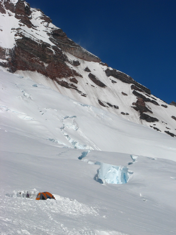 Camp Schurman (early season), Rainier N.P. |
| 2011 | |||
|---|---|---|---|
| Date | Peak | Elevation | Route |
| 12/30 | Rigg's Hill | 4,910' | Standard |
| 12/24 | Spencer Butte, OR | 2,054' | South Willamette TH |
| 12/23 | Mount Baldy (OR) | 1,224' | From Redtail Lane |
| 12/22 | Mount Baldy (OR) | 1,224' | From Redtail Lane |
| 12/10 | Mt. Bancroft | 13,250' | East Ridge |
| 11/27 | Shirttail Peak | 7,340' | Gambit |
| 11/21 | Homer and Marge, UT | ... | Chili Cookoff |
| The Happy Turk | ... | Standard | |
| 11/20 | Ring Arch | ... | ??? |
| Elephant Butte | 5,653' | West Fins | |
| 11/19 | Devil's Golfball, Arches N.P. | ... | Standard |
| 11/12 | White Spire | ... | South Ridge |
| 10/31 | Third Flatiron | ... | East Face Standard |
| 10/21 | Third Flatiron | ... | East Face Standard |
| 10/19 | The Seal | ... | East Face North Side |
| 10/16 | The Matron | ... | East Ridge |
| 10/15 | South Shanahan Slab | ... | Southeast Ridge |
| South Shanahan Slab | ... | South Face | |
| Tiny Tower | ... | East Face | |
| 10/14 | First Flatiron | ... | Direct East Face |
| 10/13 | First Flatiron | ... | Baker's Way |
| Sunset Flatironette | ... | Chase the Sun | |
| 10/7 | Satan's Slab | ... | East Face aka Purgatory |
| 10/5 | Third Flatiron | 7,220' | East Face Standard |
| Second Flatiron (not true summit) | ... | Freeway | |
| 10/1 | North Gateway Rock | 6,740' | Tourist Gully |
| South Gateway Rock | 6,660' | South Ridge | |
| White Spire | 6,500' | South Ridge | |
| Pigeon Rock | 6,500' | South Ridge | |
| The Three Graces | 6,530' | Windows Route | |
| Montezuma's Tower | 6,540' | North Ridge | |
| 9/17 | The Pickle | ... | Pin Ladder |
| Bullwinkle Tower | ... | West Chimney | |
| Owl Rock | ... | ... | |
| Elephant Butte | ... | West Fins | |
| 9/16 | Ancient Art (attempt) | ... | Stolen Chimney |
| Independence Monument | 5,739' | Otto's Route | |
| 9/11 | First Flatiron | 7,300' | Kamikaze Roofs |
| Sunset Flatironette | 7,260' | Chase the Sun | |
| 9/10 | Third Flatiron | 7,220' | Winky Woo (Direct Woo Variation) |
| Queen Anne's Head | ... | East Face | |
| 8/27 | Dreadnaut aka the Rainbow | ... | Primal Rib |
| The Achean Pronouncement | ... | East Face | |
| 8/24 | W.C. Field's Pinnacle | ... | A Very Ament's Slab |
| 8/19 | Second Pinnacle | ... | ... |
| ... | First Pinnacle | ... | ... |
| 8/12 | Lone Eagle | 11,940' | North Face |
| 8/10 | San Luis | 14,014' | NE Ridge |
| 8/9 | Mount Sneffles | 14,150' | SW Ridge |
| 8/8 | Teakettle | 13,819' | SE Ridge |
| "Coffeepot" | ... | ... | |
| 8/4 | Third Flatiron | 7,220' | East Face Standard |
| 7/27 | Pellaea | ... | East Face |
| 7/24-25 | The Spearhead | 12,575' | North Ridge |
| 7/21 | The Hammerhead | ... | Yodeling Moves |
| Cavernous Sinus | ... | Secret Entrance | |
| Challenger | ... | East Face | |
| Green Mountain Pinnacle | 7,460' | Takin' Care of Business | |
| 7/19 | The Matron | 7,220' | North Face |
| 7/16 | Longs Peak | 14,255' | Keyhole Ridge |
| 7/13 | First Flatiron | 7,300' | Fandango - Roach's variation |
| 7/6 | Remnant Tower aka the Defecating Monk | ≈5,150' | Squeeze Box |
| 7/1 | Cline Buttes, OR | 4,101' | East Slopes |
| 7/1 | Black Butte, OR | 6,436' | Standard |
| 6/24 | Spencer Butte, OR | 2,054' | South Willamette TH |
| 6/14 | Mount Rainier, WA | 14,411' | Emmons/Winthrop Glacier |
| 6/10 | Mount Hood, OR | 11,239' | Old Chute Variation |
| 6/7 | Devil's Kitchen "Lemon Squeezer" | ... | Lemon Squeezer w/ Lime Squeezer Descent |
| 6/6 | "Titanic Rock" aka "Lusitania", CO National Monument | ... | West Ramp |
| 5/28 | The Happy Turk, UT | ... | Standard |
| 5/27-28 | Moonlight Buttress, UT (attempt) | ... | Moonlight Buttress |
| 5/22 | Second Flatiron | 7,096' | Freeway |
| 5/21 | First Flatiron | ... | Baker's Way to Slot Variation |
| Second Flatiron | 7,096' | Freeway | |
| 5/16 | Frontporch | 6,792' | Tiptoe Slab |
| 5/9 | The Slab | ... | Diagonals |
| 5/4 | Northern Dinosaur Egg | ... | Re-Hatch |
| Southern Dinosaur Egg | ... | Hatch | |
| 4/16 | Bear Peak | 8,461' | Fern Canyon to Green-Bear |
| 4/9 | Second Flatiron - South Block | ... | South Ridge |
| 3/31 | Cabezon Peak, NM | ... | "The Easy Way" |
| 3/30 | Mexican Hat, UT | ... | Bandito Route |
| 3/28 | Pensive Putterman, UT | ... | All Along the Putt-Tower |
| The Happy Turk, UT | ... | Standard | |
| 3/27 | Elephant Butte, UT | ... | West Fins |
| 3/26 | Independence Monument | ... | Otto's Route |
| 3/24 | Fo | ... | Quadratic Equation |
| 3/12 | Green Mountain | 8,144' | From East Green |
| East Green Mountain | 7,980' | From the Fist | |
| The Fist aka Hippo's Head | ... | East Face | |
| Fifth Flatiron | 7,391' | East Face North Side | |
| Royal Arch | ... | East Face | |
| The Regency | ... | El Camino Royal | |
| 3/2 | First Flatiron | ... | Baker's Way |
| Second Flatiron | 7,096' | Freeway | |
| 2/23 | Fi | ... | Fi Fun |
| Dinosaur Rock | 6,740' | East Face | |
| 2/21 | Table Mountain | 6,220' | South Slope |
| Frontporch | 6,792' | Tiptoe Slab | |
| 2/19 | First Flatiron | 7,300' | North Arete |
| 2/12 | Green Mountain | 8,144' | Greenman's Trail |
| 1/29 | The Three Graces | 6,540' | Windows |
| Red Twin Spire | ≈6,500' | Potholes | |
| 1/28 | White Twin Spire | ≈6,500' | South Ridge |
| 1/26 | Third Flatiron | 7,220' | East Face Left |
| 1/15 | Quandary Peak | 14,265' | East Ridge |
| 1/5 | West Pawnee Butte | 5,315' | Northeast Face |
| East Pawnee Butte | 5,375' | North Face | |
| 1/1 | Mount Baldy (OR) | 1,224' | From Redtail Lane |
 Hanging out on Cowboy Hat Tower near Grand Junction, CO |
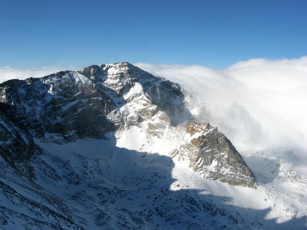 Glacier Gorge in Winter Glory |
| 2010 | |||
|---|---|---|---|
| Date | Peak | Elevation | Route |
| 12/31 | Mount Pisgah (OR) | 1,530' | Arboretum TH |
| 12/28 | Mount Baldy (OR) | 1,224' | From Redtail Lane |
| 12/24 | Cowboy Hat Tower | 4,830' | Thinkin' Hat |
| 12/22 | Cowboy Hat Tower | 4,830' | Thinkin' Hat |
| 12/15 | Devil's Backbone | 5,426' | Ridge Run |
| 12/4 | Horsetooth Mountain | 7,255' | Standard |
| 11/26 | Mount Baldy (OR) | 1,224' | From Redtail Lane |
| 11/25 | Mount Baldy (OR) | 1,224' | From Redtail Lane |
| 11/13 | Sheep Mountain | 8,450' | Round Mountain Trailhead |
| 11/6 | Ridge 3 | 7,364' | Angel's Way |
| 11/6 | Ridge 1 | 7,046' | Stairway to Heaven |
| 10/29 | Ship Rock (NM) | 7,178' | Pioneer's Route |
| 10/24 | Seal Rock | 7,260' | East Face South Side |
| 10/17 | Der Freischutz | 6,894' | Free Shot |
| 10/17 | Oveture | 6,665' | East Face Center |
| 10/16 | Hillbilly Rock | 6,999' | East Face South Side |
| 10/9 | Backporch | 7,158' | East Face |
| 10/9 | Der Freischutz | 6,894' | South Ridge |
| 10/3 | The Fatiron | 7,389' | East Face |
| 9/25 | Mount Angeles (WA) | 6,454' | Klahane Ridge |
| 9/25 | Sunrise Point (WA) | 5,420' | Klahane Ridge |
| 9/25 | PT 5,471 (WA) | 5,471' | Klahane Ridge |
| 9/25 | Hurricane Hill (WA) | 5,757' | Hurricane Hill Trailhead |
| 9/19 | Shoshoni Peak | 12,967' | From Pawnee Pass |
| 9/19 | Mount Toll | 12,979' | From Pawnee Peak |
| 9/19 | Pawnee Peak | 12,943' | Little Pawnee Traverse |
| 9/19 | Little Pawnee Peak | 12,466' | East Ridge |
| 9/11 | Apache Peak | 13,441' | Up: South Ridge - Down: East Ledges |
| 9/11 | Navajo Peak | 13,409' | Up: Airplane Gully - Down: West Chimney |
| 8/21 | "Old Baldy" | 13,038' | "4th of July" Trailhead |
| 8/21 | North Arapaho Peak | 13,502' | Arapaho Traverse |
| 8/21 | South Arapaho Peak | 13,397' | "4th of July" Trailhead |
| 8/14 | Longs Peak | 14,255' | Kiener's |
| 8/8 | Third Flatiron | 7,220' | East Face Center & Friday's Folly |
| 8/3 | Greyrock Mountain | 7,613' | Weenie Route |
| 8/3 | PT 7,309 | 7,309' | Greyrock Loop |
| 8/3 | PT 7,180 | 7,180' | Greyrock Loop |
| 8/3 | PT 6,740' | 6,740' | Greyrock Loop |
| 8/1 | Deer Mountain | 10,013' | Standard |
| 7/28 | Handies Peak | 14,048' | Grizzly Gulch |
| 7/27 | Sunshine Peak | 14,001' | From Redcloud |
| 7/27 | Redcloud Peak | 14,034' | Silver Creek |
| 7/22 | Rigg's Hill | 4,910' | Standard |
| 7/14 | South Sister (OR) | 10,358' | South Ridge |
| 7/12 | Black Butte (OR) | 6,436' | Standard |
| 7/1 | Spencer's Butte (OR) | 2,054' | From Redtail Lane |
| 6/9 | Mount Yale | 14,196' | East Ridge |
| 6/2 | Independence Monument | 5,739' | Otto's Route |
| 5/30 | Elephant Butte (UT) | 5,653' | West Fins |
| 5/28 | Southern Dinosaur Egg | 7,491' | Hatch |
| 5/27 | Dinosaur Mountain | 7,380' | Fumbledeedum |
| 5/23 | Fifth Flatiron | 7,391' | East Face South Side |
| 5/21 | The Maiden | 7,386' | North Face |
| 5/16 | Lower Tangen Tower | 6,883' | Standard |
| 5/14 | The Spy | 7,829' | East Face |
| 5/3 | Second Flatiron | 7,096' | Dodgeblock |
| 4/18 | The Morning After | 7,250' | East Face |
| 4/15 | Lower Tangen Tower | 6,883' | Standard |
| 4/12 | Green Mountain | 8,144' | From East Green Mountain |
| 4/12 | East Green Mountain | 7,980' | Tangen Tunnel |
| 4/11 | Castle Mountain | 8,834' | From Highway 34 |
| 4/2 | Liberty Cap | 5,910' | Lower Trailhead |
| 3/30 | Independence Monument | 5,739' | Otto's Route |
| 1/30 | Twin Sisters Peak East | 11,428' | Lily Lake |
| 1/17 | Mount Princeton | 14,197' | East Ridge (over Tigger) |
| 1/17 | Tigger Peak | 13,300' | Southeast Ridge |
 Sitting on Snowmass |
 'Trail Arch' - Rattlesnake Canyon, CO |
| 2009 | |||
|---|---|---|---|
| Date | Peak | Elevation | Route |
| 11/7 | Third Flatiron | 7,220' | East Face Center |
| 11/6 | First Flatiron | 7,300' | East Face Direct |
| 10/17 | Lookout Mountain | 10,715' | Meeker Park Trailhead |
| 10/2 | Second Flatiron | 7,096' | Freeway |
| 9/27 | Third Flatiron | 7,220' | East Face Center |
| 9/2 | Crestone Needle | 14,197' | Traverse from Peak |
| 9/2 | Crestone Peak | 14,294' | North Buttress |
| 9/2 | Northeast Crestone | 14,260 | North Butress |
| 8/29 | Ellingwood Point | 14,042' | Up: High traverse from Blanca - Down: Southwest Ridge |
| 8/29 | Blanca Peak | 14,345' | Traverse from Little Bear |
| 8/29 | Little Bear Peak | 14,037' | West Ridge aka Hourglass |
| 8/17 | Wilson Peak | 14,017' | Southwest Ridge |
| 8/17 | West Wilson | 14,100' | From Wilson |
| 8/17 | Mount Wilson | 14,246' | Traverse from El Diente |
| 8/17 | El Diente | 14,159' | North Buttress |
| 8/9 | North Maroon | 14,014' | Up: Traverse from Maroon Peak - Down: Northeast Ridge |
| 8/9 | Maroon Peak | 14,156' | South Ridge |
| 8/8 | Snowmass Mountain | 14,092' | Up: "S" Ridge - Down: West Slopes |
| 8/8 | North Snowmass | 14,017' | From Snowmass |
| 8/5 | North Eolus | 14,039' | South Ridge |
| 8/5 | Mount Eolus | 14,083' | Northeast Ridge |
| 8/4 | Windom Peak | 14,082' | West Ridge |
| 8/4 | Sunlight Peak | 14,059' | South Face |
| 7/31 | Wetterhorn Peak | 14,015' | Southeast Ridge |
| 7/23 | Uncompahgre Peak | 14,309' | From Matterhorn Creek |
| 7/19 | Conundrum Peak | 14,060' | From Castle |
| 7/19 | Castle Peak | 14,265' | Northeast Ridge |
| 7/18 | Pyramid Peak | 14,018' | Northeast Ridge |
| 7/17 | Capitol Peak | 14,130' | Northeast Ridge |
| 7/11 | La Plata Peak | 14,336 | Southwest Ridge |
| 7/10 | Huron Peak | 14,003' | Southwest Slopes |
| 6/4 | Mount Shavano | 14,229' | Angel of Shavano |
| 5/13 | Elephant Butte (UT) | 5,653' | West Fins |
| 1/19 | Mount Sherman | 14,036' | Southwest Ridge |
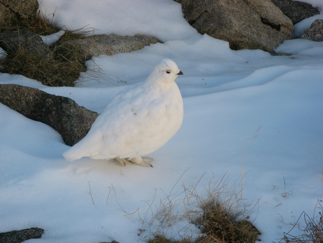 Winter Ptarmigan in the Indian Peaks |
 Twin Owls in Lumpy Ridge |
| 2008 and Before ... very, very fuzzy | |||
|---|---|---|---|
| Date | Peak | Elevation | Route |
| 11/13/2008 | Pikes Peak | 14,110' | Crags |
| 9/1/2008 | Crestone Peak | 14,294' | Northwest Couloir |
| 8/28/2008 | Mount Bross | 14,172' | DeCaLiBron |
| 8/28/2008 | Mount Lincoln | 14,286' | DeCaLiBron |
| 8/28/2008 | Mount Cameron | 14,238' | DeCaLiBron |
| 8/28/2008 | Mount Democrat | 14,148' | DeCaLiBron |
| 8/28/2008 | Quandary Peak | 14,265' | West Ridge |
| 8/10/2008 | Maroon Peak | 14,156' | South Ridge |
| 7/20/2008 | Longs Peak | 14,255' | Clark's Arrow |
| 7/20/2008 | Mount Meeker | 13,911' | Iron Gates |
| 7/17/2008 | Christmas Tree Mountain | 8,586' | Standard |
| 6/8/2008 | Mount Lady MacDonald (AB) | 8'546' | Normal Route |
| 6/3/2008 | Mount Yamnuska (AB) | 7,349' | Yamnuska Traverse |
| 6/2/2008 | Heart Mountain (AB) | 7,004' | Northwest Ridge Loop |
| 3/13/2008 | Liberty Cap | 5,910' | Lower Trailhead |
| 9/4/2006 | Torreys Peak | 14,267' | Kelso Ridge |
| 8/16/2006 | Mount Bierstadt | 14,060' | Sawtooth Ridge |
| 7/6/2006 | Longs Peak | 14,255' | Keyhole |
| 6/25/2006 | Mount Bierstadt | 14,060' | Sawtooth Ridge |
| 6/11/2006 | Grays Peak | 14,270' | Standard |
